


The South African government has raised concerns about an upcoming drop in temperatures, issuing a second weather alert in less than two weeks, warning citizens to prepare for potential snowfall. Acting Minister of Cooperative Governance and Traditional Affairs, Mmamoloko Kubayi, has advised South Africans to exercise caution following an alert from the South African Weather Service (SAWS).
Recent Snowfall Impacts Multiple Provinces
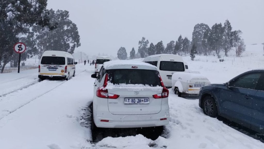
Over the past weekend, various regions across the country, including Gauteng, Free State, Mpumalanga, KwaZulu-Natal, and the Eastern Cape, experienced heavy snowfall. The severe weather conditions disrupted major roadways, particularly the N3 toll route, leaving many motorists, truck drivers, and bus passengers stranded. Unfortunately, the hazardous conditions also led to the loss of life.

Light Snow Expected Over the Drakensberg
According to SAWS forecasts, light snowfall is anticipated this weekend over the Drakensberg mountain range. Meteorologists predict a significant shift in weather patterns, with colder temperatures expected across the escarpment regions of South Africa, stretching from the Western Cape to southern KwaZulu-Natal.
Cooling Temperatures Starting Sunday
Weather reports suggest that daytime temperatures will begin to drop in the Western Cape on Sunday, 29 September 2024. The cooling trend will then spread to the Eastern Cape and KwaZulu-Natal by Monday, 30 September 2024.
SAWS further indicates that snowfall will likely follow this pattern, beginning in the Western Cape early Sunday and moving eastward toward KwaZulu-Natal by Monday morning.
Snowfall to Persist in Eastern Cape and KwaZulu-Natal
While snowfall is expected to clear up in the Western Cape and western parts of the Eastern Cape by Monday evening, it will continue in the eastern parts of the Eastern Cape and southern KwaZulu-Natal through Tuesday, 1 October 2024.
Cold Front to Bring Rain and Strong Winds
Alongside the cold front, rain and showers are predicted for the Western Cape and nearby areas. Temperatures in higher-altitude regions could fall below 10°C on Monday, and the South Coast should brace for strong winds and large ocean swells. Rainfall is forecast to reach around 30 mm between 29 September and 1 October, with light snow anticipated in high-altitude areas of the Western Cape, Northern Cape, Eastern Cape, and southern KwaZulu-Natal.
Government Issues Safety Precautions
In response to the weather warnings, Acting Minister Kubayi has urged citizens to remain alert and follow SAWS guidance. She recommends staying indoors, dressing warmly when venturing outside, and covering the mouth in extreme cold to protect the lungs.
The minister also advised against alcohol, caffeinated beverages, and smoking, as these can increase the risk of hypothermia and frostbite. Residents, particularly farmers, have been asked to ensure their small livestock is sheltered from the cold.


